Refugee camp planner
Refugee camps are a measure of last resort. But when it comes to them, they should be designed in a responsive manner taking into account the guidelines defined by #UNHCR and other actors in the field.
Below is a breakdown of a tool that can help professionals in the field to do their job easier. Although by no means this tool is capable of generating final valid solutions, it still may significantly foster the work routine of the refugee camp site planner.
Below is the breakdown of the algorithm
Zoning and plot distribution
The algorithm is intended to work in a semi-automated manner. The site planners inputs the constraining geometry and numerical data and the algorithm carries out the part of the work that can be automated.
A graphical algorithm editor (Grasshopper for Rhino3D with few plugins) was used to make the script.
Once the script is automated it populates the necessary layers that the planner will use. It’s done through ghPython and rhinoscriptsyntax library.
import rhinoscriptsyntax as rs
import Rhino
import scriptcontext as sc

sc.doc = Rhino.RhinoDoc.ActiveDoc

layers = ['camp site', 'shelters', 'roads', 'sanitation']
for l in layers:
    rs.AddLayer(l)
Once the planners start adding geometry to the designated layers they are automatically referenced into the script through Human.
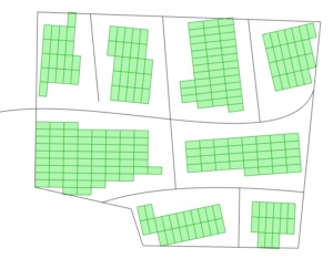
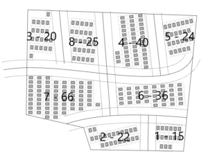
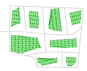
Once the boundary and the road curves a drawn the script finds the areas that can be used for further placement of shelter plots.
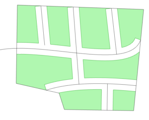
Then the untrimmed versions of those areas are subdivided with the given dimensions which are normally derived from guidelines such as the UNHCR guidelines.

Then in order to cull the ones that are out of the boundaries, the following logic has been implemented. If the sum of the distances of the points to the area is bigger than the threshold then that plot is culled.
Since this portion of the workflow is data-driven, then the user can have real-time feedback about the quantities.
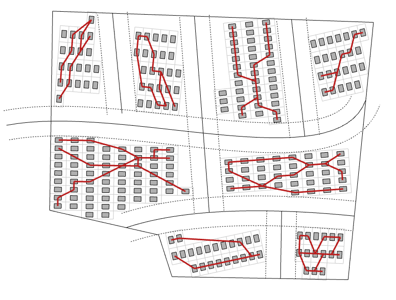
Fire safety
Fire safety is a major concern in refugee camps. That’s why there are also safety standards developed by UNHCR which constitute that the shelters should be preferable apart with the dimension of their heights from each other. Also, there are the standards of the fire break distance and the longest distance that can be built without having such a fire break.
The above-mentioned standards are embedded in the algorithm so the site planner can have instant feedback about the zones of the shelters that are within a common fire area. The shelters that are identified to be in the same fire zone (measured by spatial proximity and not necessarily coinciding with a mapping cluster) all the possible walking routes are calculated between the pairs of the shelters given the connectivity graph of the cluster using the Delaunay connectivity and a shortest walk algorithm.


From this collection of potential fire spreading routes the ones that have exceeding lengths are drawn on the map so that the site planner can see the risk.
WASH
One of the tasks of the site planner is to decide where to place the WASH units, such as toilets, showers etc. There are governing guidelines here as well which determine the maximum walking distance from the shelter to the WASH facility. The algorithm has integrated analysis of the placed WASH points in relation to shelters. It interactively shows the shelters that are within reach and the ones that are still to be satisfied.

Future work
The semi-automated data-driven method of refugee camp spatial planning is a very compelling way of working, yet still many aspects of the job have to be developed and implemented into the algorithm.